Landscape, drainage features, topography and local context of the site have been considered while preparing the concept layout for the proposed development.
The following plan shows some of the features and constraints that have informed the emerging outline proposals. Key constraints include:
- Overhead National Grid power lines and pylons, with associated easements restricting built development.
- Localised areas of surface water flood risk and identified pluvial flow routes influencing layout.
- Adjacent ancient woodland (Tower’s Covert) requiring an appropriate buffer and sensitive treatment.
- Presence of existing utilities infrastructure, including water mains and drainage easements.
- Location within the Green Belt, requiring a landscape-led and policy-compliant approach.
- Noise and air quality considerations due to proximity to main roads and nearby emission sources.
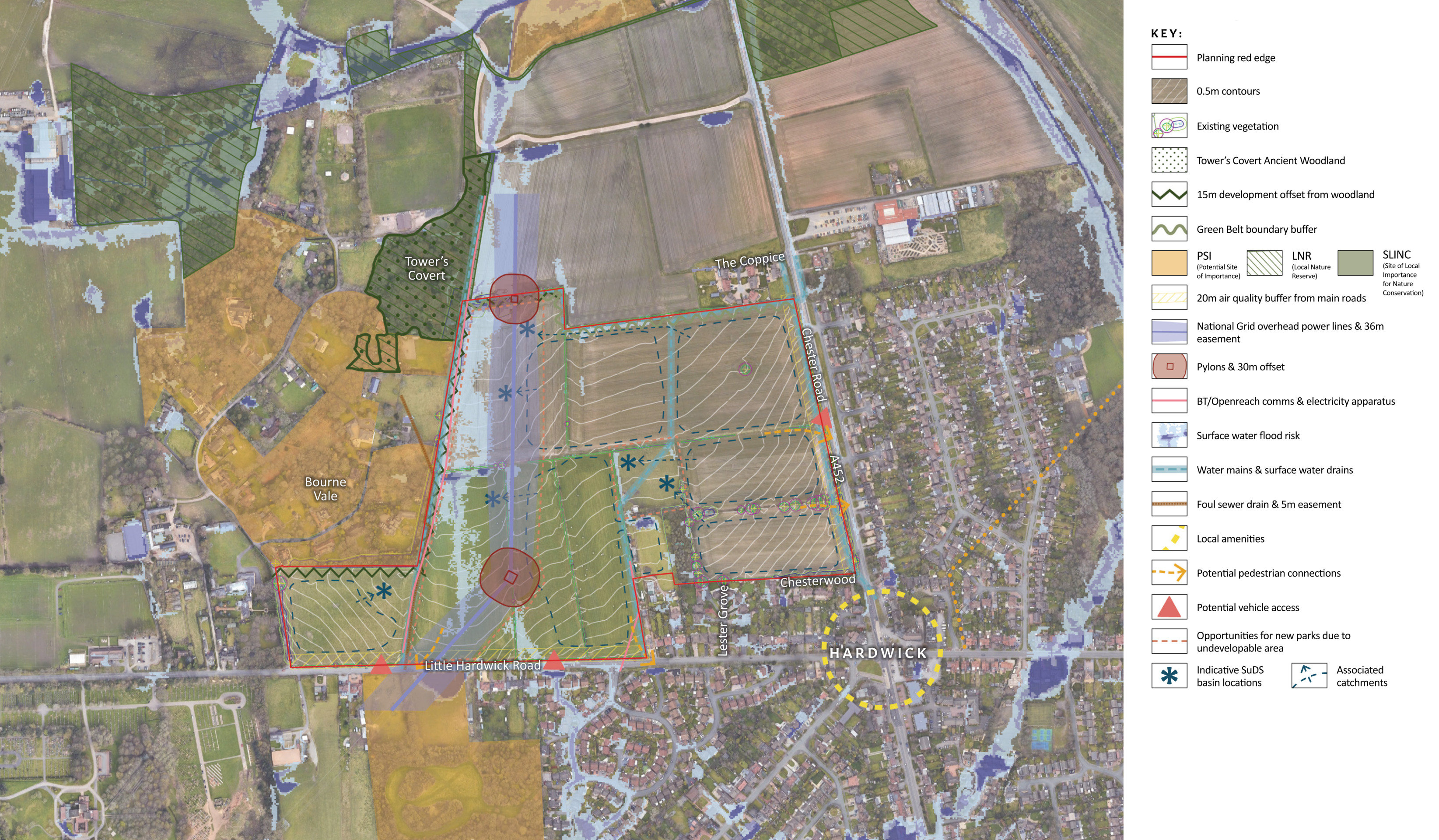
This plan shows an early analysis of some of the site features that have influenced the illustrative masterplan for the site - click to enlarge